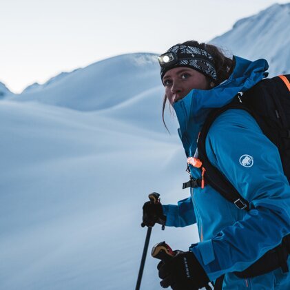
Are you planning a ski tour, a snowshoe hike, a freeride adventure or other winter sports activities in the backcountry? Then you should definitely check the avalanche forecast beforehand.
Are you new to avalanche awareness? No problem! INTERSPORT rent has summarised the basics of assessing avalanche warning levels and more. You'll learn how to read, understand and interpret the information correctly.
What is an avalanche forecast?
The avalanche forecast provides information on the current avalanche situation, taking into account the local weather and snow conditions. It always covers a larger territory (at least 100 km2), and it aims to inform the public about a possible avalanche risk.
The avalanche forecast (Switzerland: avalanche bulletin) is created by regional or national avalanche warning services – usually throughout the winter months or as long as there is snow on the mountains. The European Avalanche Warning Service (EAWS) offers an overview of the general services of the individual countries.
The data collected comes from a regional network of weather stations. In Tyrol (Austria) alone, there are about 180 of these stations. In addition, experts create snow profiles, explore the terrain, and collect information from external observers. From all this data, a kind of average value is calculated for the region.
What information does an avalanche report provide?
The avalanche forecast forms the basis for a thorough risk assessment of the situation, taking into account the weather and current snowpack stability. It answers the following questions, for instance:
- How great is the avalanche risk? (avalanche warning level/danger rating)
- Where can avalanches occur? (danger zones)
- What is the main source of danger? (avalanche problem)
Thanks to the EAWS (European Avalanche Warning Services), there are shared standards for avalanche reports throughout Europe, including an official scale for the avalanche danger ratings and the classification of avalanche problems. The structure of the reports is similar for each country as well. It was modelled after the information pyramid ("First things first" or "From easy to difficult"):
- avalanche danger rating
- sources of danger
- danger zones
- detailed description of the dangers
- additional information on weather, snowpack, and tendency
Easy to understand
The header of the avalanche forecast shows numbers, symbols and maps. This ensures that even people who do not speak the respective language can grasp the most important information. However, that’s only half the battle. What matters more is knowing how to correctly extract and interpret the information that is relevant for planning your tour.
The five avalanche warning levels and what they mean
How high is the general avalanche risk in the entire region? The avalanche danger rating answers this question at first glance. The official European Avalanche Danger Scale distinguishes five levels, from 1 (low) to 5 (very high).
The avalanche danger rating is influenced by the following factors:
- snowpack stability
- likelihood of an avalanche being triggered
- extent of the danger zones
- type and size of the expected avalanches
The following applies: The higher the warning level, the more unstable the snowpack, the more danger zones there are, the greater the probability of triggering an avalanche, and the greater the danger of big avalanches.
Level 1: low (green)
- Snowpack: well bonded and stable in general
- Avalanche triggering: generally possible only from high additional loads in isolated areas of very steep, extreme terrain. Only small and medium natural avalanches are possible.
Level 2: moderate (yellow)
- Snowpack: only moderately well bonded on some steep slopes; otherwise well bonded
- Avalanche triggering: possible, primarily from high additional loads, particularly on indicated steep slopes. Very large natural avalanches are unlikely.
Level 3: considerable (orange)
- Snowpack: moderately to poorly bonded on many steep slopes
- Avalanche triggering: possible, even from low additional loads, particularly on indicated steep slopes. In certain situations, some large, and in isolated cases very large natural avalanches are possible.
Level 4: high (red)
- Snowpack: poorly bonded on most steep slopes
- Avalanche triggering: likely, even from low additional loads, on many steep slopes. In some cases, numerous large and often very large natural avalanches can be expected.
Level 5: very high (dark red)
- Snowpack: poorly bonded and largely unstable in general
- Avalanche triggering: Numerous very large and often extremely large natural avalanches can be expected, even in moderately steep terrain.
Notes on interpreting the avalanche danger rating
The avalanche danger rating is primarily used for individual risk assessment. If the avalanche danger is low, you’re more or less safe to assume there won’t be any major avalanches. If the avalanche danger is high, on the other hand, you need to weigh very carefully whether you should venture out into the backcountry. That’s true even for experienced alpinists.
The most difficult decision is the one you have to make when the danger level is at two or three. In this case, it’s crucial to carefully read and assess the details of the avalanche forecast with regard to the planned route: Which altitudes and slopes are considered potentially dangerous? What type of avalanche is likely to occur, and how can I avoid triggering one?
Keep in mind: The avalanche danger rating is the sum of various factors and applies to a larger area, so the risk may vary in certain locations. The report often includes information on different altitudes (e.g. above and below 2,000 m) or times of day (e.g. morning/afternoon).
Danger zones
Where in the respective region can avalanches occur? This question is answered in the avalanche forecast by means of danger zones. You will find symbolic information regarding altitude (metres) and exposure (north-east-south-west). These symbols specify where there is an increased risk for avalanches. The so-called core zones are marked black.
The text points out steep or shaded slopes, areas close to ridges, or transitions from little to a lot of snow. Of course, this information is only useful if you are able to recognise and avoid the described locations in the open terrain.
The information on danger zones also includes details on snowpack stability and additional load required for triggering an avalanche. In this case, it’s a matter of taking the right precautions when going on a tour. Depending on the situation, you might walk or ski critical sections alone or in a group and with or without distances between individual members of the group.
Sources of danger
What is the avalanche problem? Or in other words: What is the main source of danger at the moment? Knowing this information can help you recognise and assess the risk. For this purpose, standard avalanche problems were identified:
- new snow: current or recent snowfall
- wind-drifted snow: snow transported by wind with or without concurrent snowfall
- persistent weak layers: weak layers of snow in the old snowpack
- wet snow: water infiltrated the snowpack due to snow melt or rain
- gliding snow: entire snowpack is gliding on the ground, typically on smooth ground such as grassy slopes or smooth rock zones
Taking a look at the problem helps you answer several questions:
- What is the problem?
- Which type of avalanches are to be expected?
- Where, when and why are they likely to occur?
- How do I identify the problem in the open terrain?
- What do I do when the problem occurs?
Tip: To recognise danger zones and correctly assess sources of danger, you should only go out into the open terrain with experienced mountaineers.
Additional information in the avalanche forecast
The avalanche forecast contains further information on the consistency of the snowpack. Finally, in the last part, there is a tendency forecast for the weather and the avalanche danger for the following days. This is particularly useful if you plan to set out on a tour at a time of day when there is no up-to-the-minute report available yet.
What types of avalanches are there?
Avalanches have many causes and forms. Some are triggered by people, others occur naturally. Some break away in lines, others in points. The snow can be either wet or dry. The avalanche forecast answers the question: Which avalanches are to be expected, and what’s their release mechanism?
There are four common types of avalanches:
- Snow slab avalanches: These are the primary threat in winter. They are usually triggered by people. In a snow slab, huge amounts of snow suddenly start to move. Another characteristic: a bonded layer of snow lying on top of a weak layer spanning a large area (layer with little bonding between snow crystals)
- Wet snow avalanches: The main trigger is water in the snowpack, which weakens bonding between layers of it. Wet snow avalanches can consist of a slab or loose snow. They usually occur naturally – mainly in spring, when it rains or gets warmer.
- Gliding avalanches: These occur when the snow starts to slide due to a large-scale loss of traction between the ground and the snowpack. Gliding avalanches are not normally triggered by humans and are particularly difficult to predict. To avoid the risk of this type of avalanche, you should stay away from zones with so-called fish mouths (cracks that run through the entire snowpack and expose the ground underneath).
- Loose snow avalanches: This type of avalanche fans out from a point of triggering, creating a pear-shaped fall path. Loose snow avalanches can be triggered by people or occur naturally, and they are rarely dangerous for winter sports enthusiasts. Nevertheless, you should be vigilant in rainy and warm weather to avoid being swept away by an avalanche further up the slope.
Important: The steepness of the slope is a deciding factor for the release of an avalanche.
INTERSPORT Rent tip
Would you like to learn more about avalanche danger levels and the like? Then we recommend you attend an avalanche training course! You will learn the basics of avalanche awareness from seasoned experts. Many of the courses include a practical part that takes place in the open terrain. Courses are offered, for instance, at Alpine clubs and in many ski resorts.
Related articles
You may also be interested in:
